Contents:
Features
- Gallery
Gallery
Click on a picture to see the full-size version.
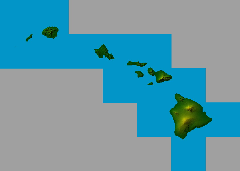 Hawaii (14 DEM Files Merged Together)
Source: USGS
Format: USGS ASCII 1-degree
Software: MacDEM.
Comments: Default shading and coloring, 2x vertical exaggeration.
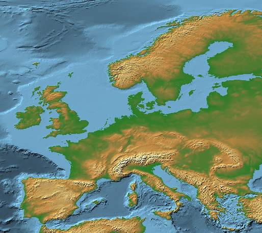 Europe
Source: NOAA (tbase.bin, tbase.hdr)
Format: NOAA TerrainBase
Software: MacDEM.
Comments: 8x vertical exaggeration, cropped, Atlas+Bathymetric palette.
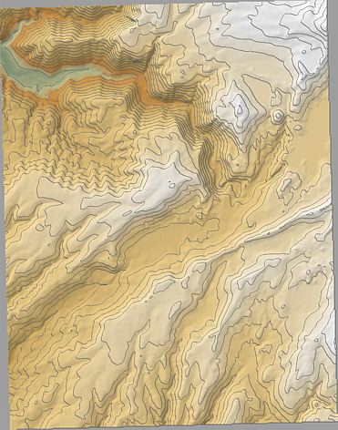 Blue Canyon, California
Source: USGS via GisDataDepot
Format: SDTS
Software: MacDEM, GraphicConverter.
Comments: Elevation units converted to feet. Contours every 200 ft.
DEM resampled at 2x for finer contour lines.
Exported to PICT. Scaled by 50% in GraphicConverter to restore size
and anti-alias contours, then sharpened.
Download MacDEM display settings
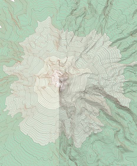 Mt. Hood, Oregon
Source: USGS via GisDataDepot
Format: SDTS (10 meter)
Software: MacDEM, GraphicConverter.
Comments: This is an example of contour maps with and without relief shading.
It also shows how bands of constant hypsographic color can be created.
Mount Hood North and South quads were merged and cropped in MacDEM.
Elevation units converted to feet. Contours every 500/100 ft.
Exported to PICT with and without shading. Each PICT scaled by 50% in
GraphicConverter to reduce size
and anti-alias contours, then sharpened, and composited.
Download MacDEM display settings
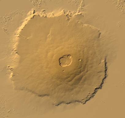 Olympus Mons (Mars)
Source: Mars Orbiter Laser Altimeter (ieg0031t.img)
Format: Raw Binary (11520 columns, 5760 rows, 0.03125 deg east and north resolution)
Software: MacDEM.
Comments: 3x vertical exaggeration, cropped, haze, custom palette.
Download MacDEM display settings
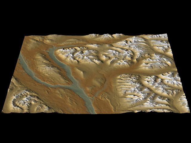 Yukon, Canada
Source:
Yukon Renewable Resources (105h_dem_90m.asc)
Format: Arc ASCII-Grid (90 meter)
Software: MacDEM, POV-Ray.
Comments: MacDEM used to import, set light direction and palette, and crop DEM, then export to POV-Ray.
Rendered in POV-Ray at 640x480 with anti-aliasing enabled.
Download MacDEM display settings